MAP OF CHESHIRE CO. NEW HAMPSHIRE FROM ACTUAL SURVEY BY L. FAGAN 1858 with an historical sketch by David R. Proper. Published by Old Maps, West Chesterfield, NH, 1981. The is a complete reproduction of the 1858 Map of Cheshire County, N.H. The original is a large wall hanging scroll that measures 25 feet. I have seen a few originals, and they are usually in tatters. That large wall map is reproduced here on 34 single sheet pages in a box.
Boxed, each sheet measures 14 by 17 inches. List of what each sheet represents is below.


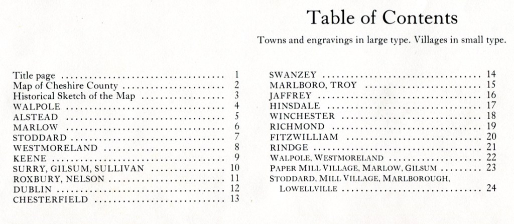
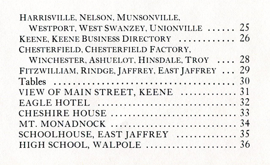
Below I have reproduced the contents page so you know what is on each sheet. The illustrations that are on the original hanging map are reproduced on the last few sheets.
Price for the Boxed Set – $70 plus $6.95 post – Order Number: 71471
I have a second set that lacks David Proper’s introduction page, and sheet 22 which is the map of Walpole and Westmoreland. If you wish to purchase this set, price $55 (plus $6.95 post), and I can provide jpg. photo images of the two lacking sheets.